The first prompt for #52ancestors in 2026 made me think about the influences in a person’s life and I decided my maternal grandmother is an ancestor I truly admire.
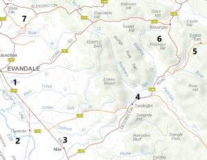
Hannah Davey was born in November 1899 at Blessington in northern Tasmania in the district of Evandale. She was the fourth daughter and sixth child out of twelve born to George Davey and Martha Colgrave.
Unfortunately her father died when she was just 14 years old. Two of her older sisters were already married by this time, so Hannah and her sister Elizabeth (Lizzie) would probably have been expected to help look after the younger children. The house the family lived in was only two rooms, so would have been very crowded especially during the cold winter months.
By 1921, Hannah’s sister Lizzie and her husband James Boxhall and three young children were living in Hobart. Perhaps this is the time when Hannah moved to Hobart and met her future husband Henry Lewis England Junior.
Hannah had sent Henry a postcard in November 1921 that had a photo of her on the front. Hannah was working as a housekeeper to the Lord family in Sandy Bay according to the 1922 electoral roll.
They married in Longford in May 1923. By the time of their marriage, Henry’s mother had passed, two of his sisters were married and his third sister had died leaving a young boy to be brought up by someone. Henry’s father was living with him at Grosvenor Street in Sandy Bay.
So Hannah began her married life with a husband, her father-in-law and a young 7 year old boy living in the same house. In 1924 her first daughter was born, 1928 her second daughter was born. I have many photos of the two girls with their parents.
In August 1932, her father-in-law passed away at home aged 77. He had been a council employee for many years but had been an invalid for many years.
In April 1934, Hannah’s third daughter (my mother) was born. Less than three weeks later, my mother’s eldest sister, Iris, died in Vaucluse Hospital which was an infectious diseases hospital in South Hobart.
In the 1950’s Hannah and her sister Lizzie then began taking care of their mother Martha who stayed six months with each of the daughters. My mother remembered the household as being very busy. Lots of cooking, lots of activities and lots of people coming to stay for a week or so.
Hannah’s mother passed in Hobart in August 1954, a couple of weeks before my parents were married. Hannah’s husband passed in 1963 and Hannah four years later.
I really admire my grandmother because of all the caring and selflessness she showed throughout her life.
- Caring for siblings, father-in-law, her husband’s nephew, her own children and finally her mother and other cousins who stayed in the house in Grosvenor Street, Sandy Bay
- Her devotion to church and her daughter’s education
Readers: Who is a person in your family history that you truly admire and why?